seaboardgàidhlig

bilingual blog dà-chànanach

Beinn Uais

Digital StillCamera

 A’ bruidhinn mun Bheinn…. 

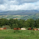
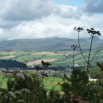
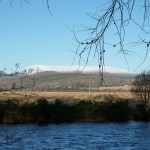
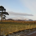
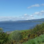
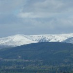
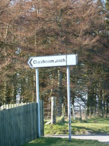
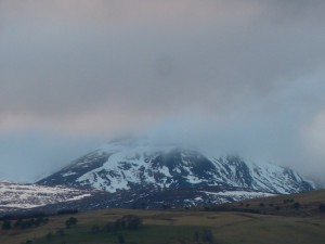
Tha sinn uile eòlach air “a’ Bheinn”, comharra-stiùiridh agus samhla Rois an Ear, agus cuspair-còmhraidh maireannach fad deich mhìosan na bliadhna co-dhiù: “Chan eil sneachd air a Bheinn fhathast, ach… / Aidh, cha bhi fada gus am bi an sneachd air ais air a’ Bheinn / Seall, tha sneachd air a’ Bheinn mar-thà /  Tha an sneachd air a’ Bheinn gu math tràth (anmoch) am bliadhna…” (amsaa gun chrìch). Tha druim Bheinn Uais na sheasamh àrd is fada os cionn Linne Chrombaid, ri fhaicinn bho Linne Mhoireibh agus bho fhada a-staigh san tìr, uile-làthaireach is druidhteach.

Ach dè cho eòlach ‘s a tha sinn air ‘ar’ Beinn ann an dà-rìribh? Tha cuid ann an Ros an Ear a tha air a dìreadh, le cinnt, ach tha amharas agam gu bheil cuid fada nas motha ann nach robh riamh air a mullach, mar mi fhìn. Bidh mi a’ togail dealbhan dhi uair is uair, fad bhliadhnaichean, gun eòlas mionaideach a bhith agam mu a deidhinn. Tha i ann, gu simplidh, na cùl-raon dhan “Linne” agus do ar pìos beag den dùthaich. Chuir mi romham barrachd fiosrachaidh fhaighinn a-mach.
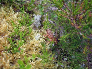
frog Ben W. Ian Mitchell CC‘S e Tèarmann Nàdar Nàiseanta a th’ anns a’ Bheinn, a fhuair an cruth àraidh a tha aice an-diugh aig deireadh Linn na Deighe o chionn mu 10,000 bliadhna, as dèidh iomadh gluasad chreagan is talmhainn tro reothadh is aiteadh na deighe, agus fo bhuaidh nan eigh-shruthan, a  thog ulbhagan bho àiteachean eile air a’ Ghàidhealtachd agus dh’fhàg iad sgapte air a’ Bheinn nan “iomraill”.  Air an adhbhar sin tha àrainneachd nàdarra na beinne gu math caochlaideach. Air na mullachan chithar raon còinnich cloimhiche as fharsaing san RA, agus anns na coireachan tha lùsan artaigeach is ailpeach. Ma bhios tu fòrtanach chì thu tàrmachan, no na h-amadain-mhòintich, a thogas an nid air talamh an dròma. Nas ìsle air na leathadan chithar beith-bheag sna boglaichean, critheann agus caorann, agus iomadh seòrsa dhearcan. (Barrachd fiosrachaidh an seo: http://www.snh.org.uk/pdfs/publications/designatedareas/BenWyvis.pdf )

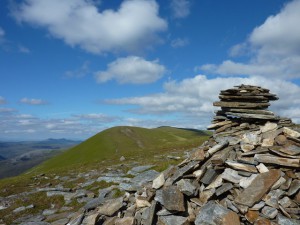
Tha an luchd-coiseachd glè dheidheil air Beinn Uais cuideachd. ‘S e sreath mhullach a tha innte agus Glas Leathad Mòr am fear as àirde dhiubh (1046m), le seallaidhean farsaing àlainn, agus (a rèir Walkhighlands http://www.walkhighlands.co.uk/lochness/Benwyvis.shtml) ‘s e aon de na An Cabar cairn Ben W. Ian Stewart CCRothachan as fhasa th’ innte – ann an sìde bhrèagha. Ach chan urrainn do dhaoine a bhith cinnteach idir gum bi an t-sìde brèagha air a’ mhullach ged ‘s a bha i aig toiseach na cuairt, mar a fhuair aon choisiche a-mach anns an Dùbhlachd (“A Scary Ben Wyvis”): “…wind must be 70-80 mph on our backs. Can’t walk,wind taking us off our feet and we slide along. Now the snow starts… visibility must be 3-4m in heavy blizzard. Everythings white, no horizon.. compass frozen over cant see it, water frozen cant drink it, slipped on ice, lost eye contact with party…” http://www.walkhighlands.co.uk/Forum/viewtopic.php?f=9&t=3380
Mar a chithar, ma-thà, faodaidh a’ Bheinn a bhith fìor araidh air ainm ‘Uais’. Chan fhaodar ràdh le cinnt co às a tha an t-ainm sin, ach tha e coltach gu bheil e ceangailte ri ‘uabhas’ air neo ‘fuathas’, an dà chuid le blas gruamach agus drùidhteach. Faodaidh beagan sneachda a bhith air fhàgail anns na coireachan fad na bliadhna, agus tha tradisean ann gum b’ fheudar do Thriath nan Rothach Foulis ballsneachda bho mhullach na Beinne a thoirt dhan rìgh gach Fèill Eòin (meadhan an t-Samraidh) gus am faigheadh e am fearann aige air a’ Bheinn a chumail. Mar a thuirt Thomas Pennant (Tour of Scotland) ann an 1769: ” .. he seems to be in no danger of forfeiting his right by failure of the quit-rent, for snow lies in the form of a glaciere in the chasms of Benwewish, a neighbouring mountain, throughout the year.” http://www.appleby.org.uk/ben_wyvis_history.htm
P1280693Ach leugh mi sgeul na b’ ùire mun Bheinn, a tha a’ dèiligeadh ris an ‘uabhas’ aice, agus ‘s e sin uabhas nach eil idir cho nàdarra ris an eagal a bha air an neach-coiseachd a dh’ainmhich mi gu h-àrd – taing do Ross and Cromarty Heritage airson seo:  “One day in August, some years ago, a local mountaineer was coming back down An Cabar when he heard a strange noise some way off. It sounded like one of those plastic containers that cakes come in, being crumpled up. It got louder and louder, and was clearly coming up the hill towards him. It was a nice sunny day, and not even a breeze. He looked about carefully for any sign of wind, or movement of the vegetation, or anything else which might explain what was happening, but there was none. By this time he had got down on one knee in case it was a twister. It continued to approach and eventually passed him about two metres away and disappeared into a nearby rock-face; then all was quiet again. A day or two later, the same man was in Inverness, walking along Ness Walk, when a large lorry pulled up – mostly on the pavement. On the nearside door was the text ‘Ben Wyvis – hill of terror’.” http://www.rossandcromartyheritage.org/communit/p37/ev/oe/p37_ev_oe01.html

Latha air choireigin tha mi fhìn airson coiseachd air mullaich Beinn Uais, gus an stòras nàdarra agus na seallaidhean brèagha fhaicinn, agus gus dearbhadh dhomh fhìn gur urrainn dhomh – ach cha bhi mi a’ dol ann sa gheamhradh agus cha bhi mi nam aonar. Agus anns an eadar-àm leanaidh mi orm a’ togail mo chuid dealbhan…

**********************************************************************

Ben Wyvis
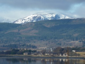
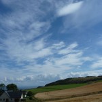
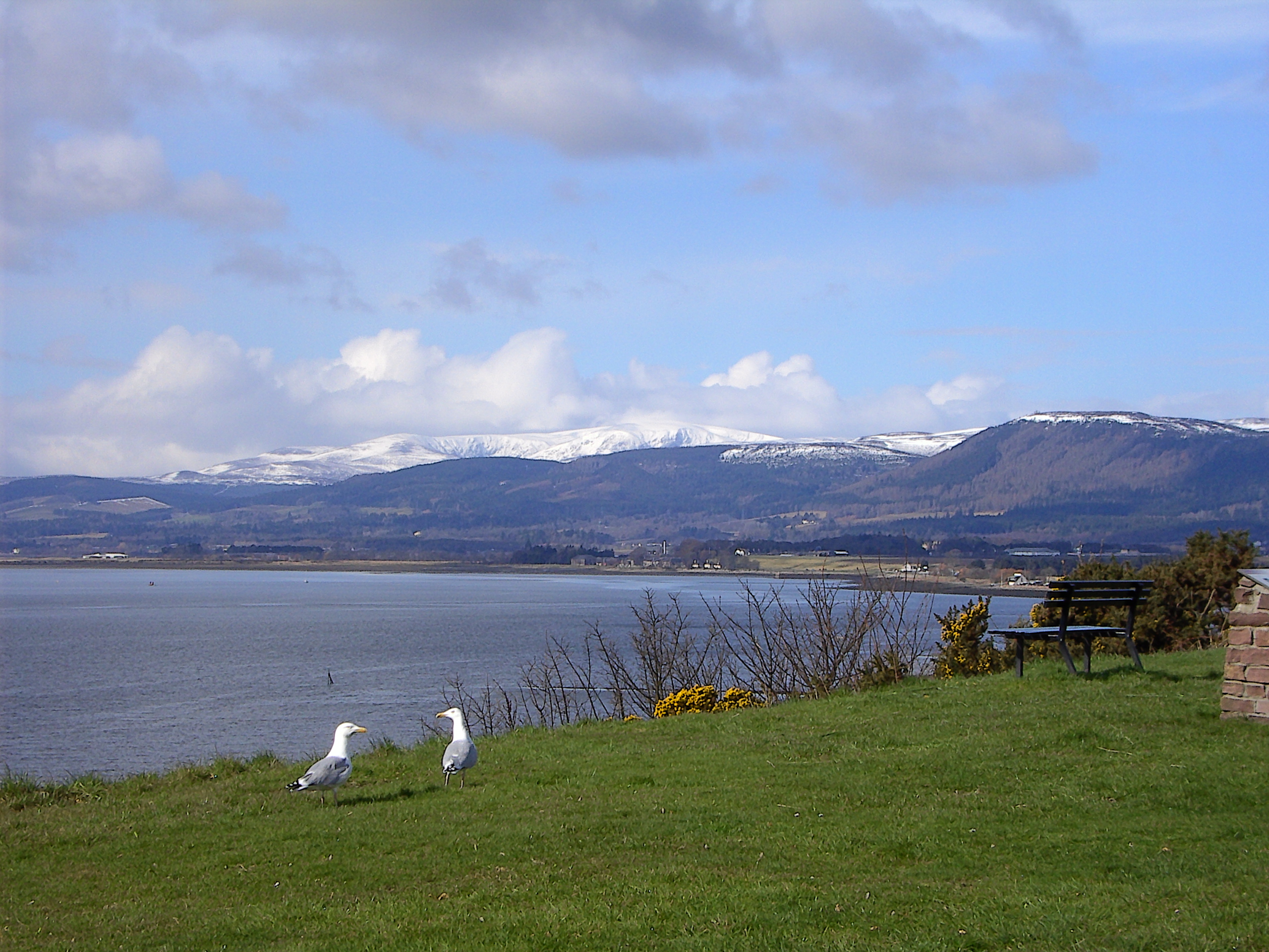
P1280714We’re all familiar with “The Ben”, landmark and symbol of Easter Ross, and inexhaustible topic of conversation for at least 10 months of the year: “No snow on the Ben yet, but.. / Aye, it won’t be long till the snow’s back on the Ben / Look, there’s snow on the Ben already / The snow’s early (late) on the Ben this year…” and so on, endlessly. Ben Wyvis’s skyline stands high and long above the Cromarty Firth, visible from the Moray Firth and from far inland, omnipresent and impressive.

But how much do we really know about ‘our’ ben? There are certainly a good few in Easter Ross who have climbed it, but I suspect that there are even more, like myself, who’ve never been on the top. I’m forever taking pictures of it, and have been for years, without actually knowing about it in any detail. It’s just there, backdrop to “the Firth” and to our wee bit of the country. I decided to find out a bit more.
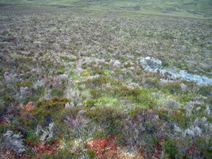
moss Ben W. Ian Mitchell 1 CCThe Ben is a National Nature Reserve. It settled into its current shape by the end of the Ice Age, about 10,000 years ago,  after many movements of rock and earth caused by the freezing and thawing of the ice, and through the impact of glaciers, which picked up boulders from other places in the Highlands and left them scattered on the Ben as ‘erratics’. For that reason the natural environment of the Ben is very varied. On the tops you see the largest area of woolly hair-moss in the UK, and in the corries there are arctic and alpine plants. If you are lucky you may see ptarmigans, or the dotterels who nest on the ground of the ridge. Further down the slopes you can see dwarf birches in the blanket bog, aspens and rowans, and many kinds of berries. (More information here:  http://www.snh.org.uk/pdfs/publications/designatedareas/BenWyvis.pdf)

Hillwalkers are also very fond of Ben Wyvis. The Ben is actually a chain of tops, the highest of which is Glas Leathad Mòr (1046 m), with extensive, beautiful views, and (according to Walkhighlands http://www.walkhighlands.co.uk/lochness/Benwyvis.shtml) is one of the easiest DSCN4963Munros – on a fine day.  But there is no guarantee at all that the weather will be fine on the top even if it was when you started out, as one walker discovered (‘A Scary Ben Wyvis’):  “…wind must be 70-80 mph on our backs. Can’t walk,wind taking us off our feet and we slide along. Now the snow starts… visibility must be 3-4m in heavy blizzard. Everythings white, no horizon.. compass frozen over cant see it, water frozen cant drink it, slipped on ice, lost eye contact with party…” http://www.walkhighlands.co.uk/Forum/viewtopic.php?f=9&t=3380
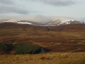
As we see, then, the Ben can certainly live up to its name, ‘Wyvis’ – an English rendering of the Gaelic ‘Uais’ or ‘Uabhais’.  It can’t be said for certain where the name came from, but it’s probable that it’s connected to the Gaelic word ‘uabhas’ (awe, terror) or ‘fuathas’ (spectre, apparition), both with a distinctly gloomy and impressive flavour. There can be some snow left in the corries all year round, and there’s a tradition that the chief of the Munros of Foulis had to deliver a snowball to the king every Midsummer’s Day if required to, in order to hang onto his land on the Ben. As Thomas Pennant said in his Tour of Scotland in 1769: ” .. he seems to be in no danger of forfeiting his right by failure of the quit-rent, for snow lies in the form of a glaciere in the chasms of Benwewish, a neighbouring mountain, throughout the year.” http://www.appleby.org.uk/ben_wyvis_history.htm 
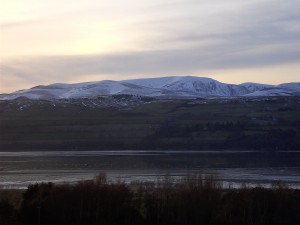
Digital StillCameraBut I read a more recent story about the Ben, which also deals with the ‘uabhas’ aspect, though this time it’s a less natural terror than the fear felt by our hillwalker mentioned above – thanks to Ross and Cromarty Heritage for this: “One day in August, some years ago, a local mountaineer was coming back down An Cabar when he heard a strange noise some way off. It sounded like one of those plastic containers that cakes come in, being crumpled up. It got louder and louder, and was clearly coming up the hill towards him. It was a nice sunny day, and not even a breeze. He looked about carefully for any sign of wind, or movement of the vegetation, or anything else which might explain what was happening, but there was none. By this time he had got down on one knee in case it was a twister. It continued to approach and eventually passed him about two metres away and disappeared into a nearby rock-face; then all was quiet again. A day or two later, the same man was in Inverness, walking along Ness Walk, when a large lorry pulled up – mostly on the pavement. On the nearside door was the text ‘Ben Wyvis – hill of terror’.” http://www.rossandcromartyheritage.org/communit/p37/ev/oe/p37_ev_oe01.html

One day I’d like to walk along the tops of Ben Wyvis myself, to see the natural heritage and the beautiful views, and to prove to myself that I can do it – but I won’t go in the winter, and I won’t go alone. And meanwhile I’ll just carry on taking my pictures….

Dealbhan san artaigil /Pictures in the article:  2, 3, 6 via Creative Commons Licence – mòran taing / many thanks!

2. Ian Mitchell  http://www.geograph.org.uk/photo/1369455

3. Ian Stewart http://www.geograph.org.uk/photo/2400032

6. Ian Mitchell http://www.geograph.org.uk/photo/1369446

Tha na dealbhan eile agam fhìn / all the other pictures are my own
 

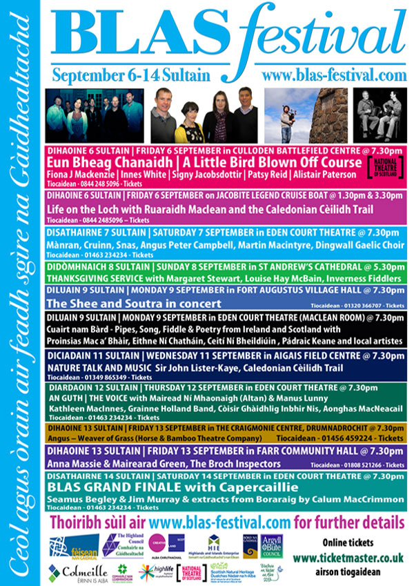
Tachartasan ionadal sgoinneil aig BLAS anns an t-Sultain!

Brilliant local BLAS festival events in September!

Blas13InvernessMC


Reasabaidhean Àisianach Samhraidh

Fhuair mi na reasabaidhean Àisianach blasda seo bho Janni Diez, Oifigear Leasachaidh Cànain aig Sabhal Mòr Ostaig ann an Slèite, Eilean Sgitheanach, a nì clasaichean-còcaireachd Gàidhlig an sin cuideachd. Mìle taing, Janni!

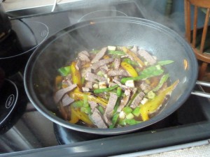
Mairt- fheòil le Sabhs Eisirean

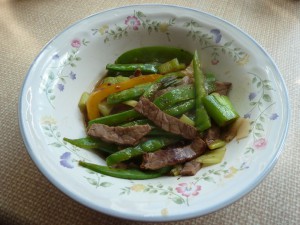
P1320186200g de mhairt-fheòil

2 spàin de sabhs soidhe

2 spàin de stuthaig

1 spàin de dh’fhìon geal

1 clòbh de chreamh

1 òirleach de dhinsear

1 Piobar uaine

1 uinnean

2 spàin de dh’ola

2 spàin de sabhs eisirean

Leth cupa de shùgh màirt-fheòla

1 spàin teatha de ola seasamain

1 spàin teatha de shiùcar

3 uinneanan an earraich

Geàrr an fheòil ann an striopan fìor thana agus cuir ann am bobhla e leis an fhìon, 1 spàin de sabhs soidhe agus 1 spàin de stuthaig. Fàg e fad 15-30 mion. Sgudaich an dinnsear agus an creamh gu mìn agus geàrr a’ ghlasraich eile ann am pìosan de 1 òirleach.

Teasaich an t-ola ann am wok gus am bi e teth. Cuir an creamh agus an dinnsear ris, ach na loisg e. Cuir na h-uinneanan agus na pioparan ris agus teasaich iad fad 5 mionaidean, ach cha bu chòir dhaibh fàs donn. Measgaich an còrr den stuthaig, an sabhs-soidhe, an sabhs eisgirean, an sùgh màirt-fheòla, an siùcar agus an ola seasamain ann am bobhla. A-nis cuir an fheòil agus an sabhs ris a’ ghlasraich san wok agus cuir mun cuairt e gu tric fad 4 -5 mionaidean. Aig an deireadh cuir na h-uinneanan an earraich ris. Feuch e, agus ma tha salann no piobar a dhìth, cuir sin ris.

 Glasraich Shearbh is Mhilis

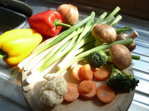
P13201811 uinnean

1 clòbh de chreamh

1 piobar dearg no buidhe

10 balgain-bhuachrach 2 churran

1 broccoli

1 càl colaig

1 crogan de bachlagan bamboo

2 spàin de dh’ola

6 spàinean fìon geur

1 spàin Taois tomàta

1 spàin stuthaig

3 spàinean siùcar

2 spàin sabhs soidhe

2 spàin de dh’uisge

Pacaid de bhachlagan soidhe

2 uinnean an earraich

Geàrr na glasraich ann am pìosan de 1 òirleach, reub am broccoli agus an càl-colaig gu flùraichean beaga agus sgudaich an creamh gu mìn. Teasaich an t-ola ann am wok agus praidhig an creamh fad mionaid aig teas meadhanach. Cuir na currain agus am broccoli ris agus praidhig fad 5 mionaidean, an uair sin cuir a’ ghlasraich eile ris. Ann am bobhla, measgaich an fhìon geur, uisge, siùcar, stuthaig agus sabhs soidhe. Nuair a tha a’ ghlasraich gu bhith deiseil, cuir ris an sabhs, na bachlagan soidhe agus na h-uinneanan an earraich air an gearradh. Teasaich e gus am bi e a’ goil, ach na goil e ro fhada, no cha bhi e geur tuilleadh.


Asian Recipes for Summer

I got these tasty Asian recipes from Janni Diez, Language Development Officer at Sabhal Mòr Ostaig College, Sleat, Skye, who also gives cookery classes in Gaelic. Many thanks, Janni!

Stir-fry Beef with Oyster Sauce

P1320187200 g tender beef

2 spoons soy sauce

2 spoons starch thickener (cornflour etc)

1 spoon white wine

1 clove garlic

1 inch of ginger

1 green pepper

1 onion

2 spoons oil

2 spoons oyster sauce

half cup beef stock

1 teaspoon sesame oil

1 teaspoon sugar

3 spring onions

Cut the meat into very thin strips and put in a bowl with the wine, 1 spoon soy sauce and one spoon thickener. Leave for 15 -30 minutes.

Finely chop the ginger and the garlic, and cut the other vegetables into one-inch pieces.

Heat the oil in a wok or equivalent until hot. Add the ginger and garlic, but don’t let them burn or catch. Add the onion and green pepper and cook for 5 minutes, without letting them brown.

Mix the rest of the thickener, soy sauce, oyster sauce, stock, sugar and sesame oil in a bowl. Add this and the meat and marinade to the pan, stirring frequently. Cook for a few minutes, then finally add the spring onions. Season to taste if required.

Sweet and Sour Vegetables

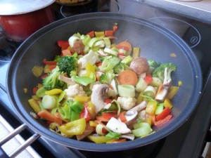
P13201841 onion

1 clove of garlic

1 red or yellow pepper

10 mushrooms

2 carrots

1 broccoli

1 cauliflower

1 tin of bamboo shoots

2 spoons oil

6 spoons vinegar

1 spoon tomato paste

1 spoon starch thickener

3 spoons sugar

2 spoons soy sauce

2 spoons water

packet of soya beansprouts

2 spring onions

Cut the vegetables into one-inch pieces, tear the broccoli and cauliflower into small florets, and finely chop the garlic.

Heat the oil in a wok or similar pan, and fry the garlic for a minute on a medium heat. Add the carrots and the broccoli and fry for 5 minutes, then add the rest of the vegetables.

Mix the vinegar, water, sugar, starch and soy sauce in a bowl.

When the vegetables are almost ready, add the vinegar mixture, the beansprouts and the chopped spring onion and bring briefly to the boil. (Don’t boil too long or it won’t be ‘sour’ at all!)


Ainmean-àite 5 – Beurla agus Beurla Ghallda

P1280868Mar a chunnaic sinn mar-thà, ‘s e eachdraidh fhada agus gu ìre chaochlaideach a bha aig Machair Rois. Ach tha aon rud ann a bha seasmhach: bha an-còmhnaidh ùidh mhòr aig luchd-riaghlaidh na h-eaglaise agus na stàite anns an dùthaich thorraich fhasgaich aig ceann Linne Mhoireibh. Bha cudromachd ro-innleachdail aig an làrach seo – dh’fheumadh feadhainn a bha a’ strì airson cumhachd poilitigiche, armailtiche, eaconamiche no cràbhaiche air a’ Ghàidhealtachd, air tìr no air muir, bunait a stèidheachadh an sin. Thàinig na daoine seo – rìghrean, uaislean, easbaigean, seanailearan, marsantan – no na riochdairean aca, gu tric à ceann a deas na h-Alba (no fiù ‘s na b’ fhaide air falbh) agus ri ùine thàinig Beurla Gallda no Beurla còmhla riutha.

Chì sinn air na seann mhapaichean (Pont, Blaeu ammsa) gu bheil mòran chruthan Beurla aig ainmean-àite far an robh cruth Gàidhlig aig muinntir na sgìre: Abbotshaven seach Port an Ab, Hilton seach Baile a’ Chnuic, Castle Tarbat seach Caisteal Baile an Lòin (Ballone), agus ri ùine nochdaidh eiseimpleiren ùra air na mapaichean: Mounteagle seach Cnoc na h-Iolaire, Broomton seach Baile a’ Bhealaidh, agus -fields gun chrìoch. Fhuair na sgrìobhadairean-mapa fios bho dhaoine ‘cudromach’ an àite, nach robh gu trice às an sgìre fhèin, fiù ‘s nam b’ e daoine foghlaimte agus fiosrachail a bh’ annta – ministearan, luchd-teagaisg, fir-lagha amsaa. ‘S dòcha gun robh iad den bheachd gur e ainmean ‘nas fheàrr’, nas fheumaile no fiù ‘s nas sìobhailichte a bh’ anns na h-eadar-theangaidhean seo, agus ri ùine bhiodh cuid de mhuinntir na sgìre a’ creidsinn seo cuideachd, agus iad a’ cleachdadh Beurla co-dhiù airson ghnothaichean na b’ fhoirmeile.

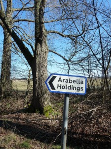
P1280813Thug luchd na Beurla seo, no in-imrichean saidhbhreachail as an dèidh (no uaislean ionadail ‘Beurlaichte’), ainmean le brìgh phearsanta air na dachaighean agus oighreachdan aca cuideachd: Brucefield seach Cnoc an Tighearna, Arabella seach Am Bog, Ankerville seach Cinn-dèis (Kindeace), Petley, Kimberley, amssa.

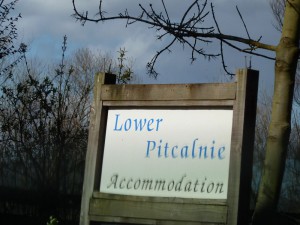
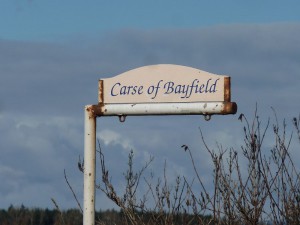
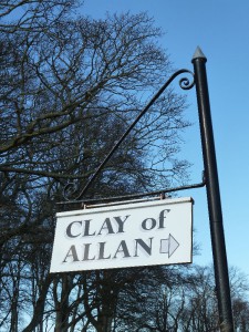
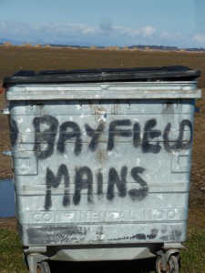
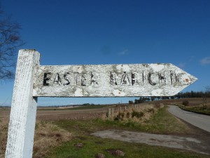
Ach bha buaidh na Beurla Gallda ann cuideachd, an dà chuid bho rùnairean is eile às a’ Ghalltachd aig àm nam manachainnean ‘s nan rìghrean, ‘s dòcha ri fhaicinn ann an Hiltoun, Newtoun, Meikle Rany (mapa aig Pont c. 1590), agus bhon fheadhainn eile a thàinig tro na linntean nan tuathanaich, ceàrdan agus iasgairean – Hirsel (croit-caorach bheag), Skinnerton, Fishertown, Carse of Bayfield. Thàinig na daoine sin, à Moireibh no na b’ fhaide gu deas, a dh’obair, gu ìre mhòr, chan ann a riaghladh, agus bha iadsan a’ fuireach taobh ri taobh le muinntir Ghàidhealach na sgìre. Tha e coltach gur e sin an t-adhbhar air an uabhas de dh’ainmean le eilamaidean measgaichte – ainmean Gàidhlig le facal Beurla no Beurla Gallda air a chur riutha – mar Little Tarrel, Easter Rarichie, Lower Pitcalzean, Loans of Fearn, Clay of Allan, Balnapaling, Nigg Mains, amsaa.

Ann an Ros an Ear, agus ann am Machair Rois gu h-àraidh, tha stòras air leth pailt de dh’fhianaisean eachdraidheil, cruinn-eòlach agus sòisealta anns na h-ainmean àite. Le bhith a’ sealltainn gu mionaideach air mapa OS an latha an-diugh, gheibh sinn a-mach cò na sluaghan a bha ann, dè na cànan a bhathar a’ bruidhinn, dè an obair a bha aig na daoine tro na linntean, cò aig a bha cumhachd phoiliteagach no eaglaiseil, agus cuin, agus cò ris a bha am fearann coltach linntean air ais. Bha agus tha am pìos fearainn seo tlachdmhor is luachmhor do dhaoine bhon taobh a-muigh.

P1280824Tha am mapa ag atharrachadh fhathast; air mapaichean OS nas ùire chì sinn na h-ainmean as aosta còmhla ris an fheadhainn nas nuaidhe: Pitcalzean agus Balnabruaich dlùth ri taobh ainmean mar ‘Nigg Oil Terminal Graving Dock’ agus ‘Helipad’. Agus ann an cuid bhliadhnaichean eile, leis an leasachadh as ùire san sgìre, ‘s dòcha gum bi seo ag atharrachadh a-rithist, agus sinn a’ sealltainn air mapa Ros an Ear air a bheil aon uair eile Cnoc a’ Mhuilinn Ghaoithe.

*****************************************************************************************

Placenames 5: English and Scots

As we have already seen, Easter Ross has had a long and fairly colourful history. But one thing has remained constant: there has always been immense interest on the part of church and state rulers in the fertile sheltered land at the head of the Moray Firth. This site was of strategic importance; anyone who was battling for political, military, economic or religious control of the Highlands, by land or sea, had to establish a base here. These people – kings, nobles, bishops, generals, merchants – or their representatives all came into the area, often from the south of Scotland (or even further afield), and in the course of time the Lowland Scots or English languages came with them.

P1280818We see on the old maps from the 1590s on (Pont, Blaeu etc) that there were many English forms suddenly appearing for places which already had Gaelic names as used by the local population: Abbotshaven instead of Port an Ab , Hilton instead of Baile a’ Chnuic, Castle Tarbat instead of Baile an Lòin (Ballone). Over time new specimens appeared on the maps: Mounteagle instead of Cnoc na Iolaire, Broomton instead of Baile a’ Bhealaidh, and umpteen placenames ending in -field. The map-makers got their information from the ‘important’ folk of the area, who often weren’t locals, even if they were educated, well-informed individuals such as ministers, teachers, lawyers etc. Maybe they actually believed that these Anglicised versions were ‘better’, more useful, or even more ‘civilised’, and over time maybe even some of the locals began to believe that too, as they had already started using English for more formal business.

These English-speakers, and later gentry incomers (or Anglicised local gentry) also gave their homes or estates names with personal significance to them: Brucefield instead of the existing name Cnoc an Tighearna (The Lord’s Hill), Arabella instead of Am Bog, Ankerville instead of Cinn-dèis (Kindeace), Petley, Kimberley etc.

P1280953But there was a Scots influence too, both from court administrators and others from the Lowlands at the time of the monasteries and the kings, probably as seen in the names Hiltoun, Newtoun, Meikle Rany on Pont’s map of 1590, and also from those who came over the centuries as farmers or farmworkers, tradesmen and fishermen: Hirsel (small sheep croft), Skinnerton, Fishertown, Carse of Bayfield etc. These people from Moray and further south came, to a large extent, as ordinary workers rather than administrators, and they would have lived side-by-side with the local Gaelic-speaking population.  It’s likely that that is the reason for the large number of mixed names with Gaelic roots and  English or Scots appendages, like Little Tarrel, Easter Rarichie, Lower Picalzean, Loans of Fearn, Clay of Allan, Balnapaling, Nigg Mains etc.

In Easter Ross, and especially on the Seaboard, there’s a wealth of historical, geographical and social evidence in the local placenames. If we look closely at the OS maps even today, we can find out which peoples lived there in the past, what languages were spoken, what work people did there over the centuries, who had the political or ecclesiastical power (and when), and what the land looked like centuries back. This piece of the country was and still is attractive and valuable to those from outside its borders.

P1280874The map is still changing. On recent OS maps we see the oldest names side by side with modern ones: Pitcalzean and Balnabruaich close to names like  ‘Nigg Oil Terminal Graving Dock’ and ‘Helipad‘. And it may not be long before that changes again, and (given the latest developments) somewhere on the map of Easter Ross we will once again have a Cnoc a’ Mhuillinn Ghaoithe – Windmill Hill.

Ainmean-Àite 4:

na Gàidheal – Creideamh is Caistealan

Creideamh

P1230261 (2) Shandwick BayGed a dh’fhaodas a bhith fianais air ‘Draoidhean’ anns an sgìre anns na h-ainmean ‘Port an Druidh’, agus ‘Cadha Port an Druidh’ air Beinn Neig, ‘s dòcha ceangailte ris  na Decantae (c. 120 BC), chan eil eòlas cinnteach againn dè na h-ainmean-àite a dh’fhaodas a dhol air ais chun an àm ron chreideamh Chrìosdail. Mar a chunnaic sinn, ‘s dòcha gur e am facal Gàidhlig ‘righ’ a tha air cùl ‘druidh’. Tha mòran tobraichean ann, gu h-àraidh ann am paraiste Neig, mar Tobar na Slàinte, fhathast ann an-diugh fhèin, air a’ chladach faisg air Port an Druidh, agus Tobar Chormaig, faisg air an tuathanas aig Seannduig. Tha làrach Tobar na h-Iù faisg air ‘an t-sìthean’ (Dùn Rath-riachaidh, Rarichie), agus bha feartan draoidheil leigheis aice a rèir coltais. Bha agus tha saobh-chràbhadh riamh ann anns na bailtean-iasgaich, taobh ri taobh le creideamh Crìosdail làidir, ‘s dòcha air fhagail aca bho àm nan Ceilteach na bu thràithe. Bha an saoghal ro chruaidh ‘s gum biodh iad a’ diùltadh cuideachadh de sheòrsa sam bith.

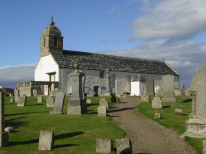
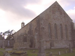
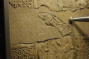
Old Tarbat Church, site of Pictish monasteryAch ‘s ann bhon eaglais Chrìosdail a thàinig an àireamh a bu mhotha de na h-ainmean anns an roinn seo. Bho àm Chaluim Chille co-dhiù bha eaglaisean agus manaich ann, gu h-àraidh aig Port MoCholmaig, (Port Naomh Colmag / St Colman) far an robh manachainn Chruithneach. As dèidh sin thàinig Manachainn Rois.  ‘S e ‘Feàrn’ an t-ainm a bha oirre roimhe, oir dh’imrich a’ mhanachainn bho Fheàrn, faisg air Eadardan, agus ‘s e Fearn an t-ainm a chùm i sa Bheurla. ‘S e Port an Ab an seann ainm ionadail air Baile an Todhair.  Thug Templecroft faisg air Bindal ainm bho Theampall Earach, uamh anns na creagan far an robh (a rèir beul-aithris) seirbheisean-eaglais de sheòrsa air choreigin.

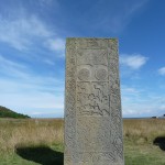
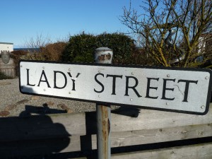
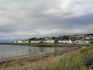
Chapel site and Stone, HiltonAig Baile a’ Chnuic tha làrach Caibeal Mhoire ann le ‘Creag na Baintighearna’ air an tràigh, agus ‘Bàrd Mhoire’ (agus Lady Street sa bhaile fhèin, ainm a thàinig le cinnt bho na linntean ron Eaglais Chlèirich.) Tha tobraichean ann an sin cuideachd, m.e. am fear faisg air an allt (is e ga chleachdadh fhathast nuair a bha mise òg), agus fear eile faisg air làrach cladh a’ chaibeil, Lady’s Well, far an deach clann gun bhaisteadh a thiodhlacadh. Thachair an aon rud ri taobh Clach a’ Charraidh, ainm ionadail air Clach Sheannduaig, agus tha e coltach gun deach an fheadhainn a thiodhlachadh an sin cuideachd a dh’eug den cholera. Do na truaghain sin, bha na tursachan Cruithneach iongantach seo, leis na samhlaidhean Crìosdail orra, nan ‘carragh’ dhà-rìribh.

Tha pàirt de Phort MoCholmaig air a bheil Gaza mar ainm; ‘s e ainm bìoballach a th’ ann, agus tha dà mhìneachadh ionadail ann, a rèir Watson: airson ‘s gun robh e mar fhàsach leis a’ ghainmheach a bh’ ann, no air sgàth ‘s gun robh “muinntir Ghaza” (‘Philistines’) aig a’ mhinistear air na daoine an àite leis nach biodh iad a’ dol dhan eaglais tric gu leòr! 

Caistealan is Daighnichean

 B’ fhìach riamh fearann torrach Mhachair Rois a dhìon, agus bho na linntean a bu thràithe tha iomadh ràth, dùn agus caisteal ann, no tha co-dhiù na h-ainmean air fhàgail againn.

ràth            daighneach cruinn (Ceilteach no na bu thràithe)

Rhynie             ràthan (tha dà ann, Rhynie agus Meikle Rhynie)

P1280880Rarichie            ràth-riachaidh (air sgàth nan drisean no a’ chonaisg a th’ ann fhathast?) – làrach daignich Chruithnich, air an robh fhathast ‘Danish Fort’ air a’ mhapa OS 1911. Bha muinntir a’ bhaile riamh glè dheònach creidsinn gum b’ ann bho na Lochlannaich a bha gach leac is dùn, fiù ‘s na leacan Cruithneach fhèin (chuala mi fhìn an sgeul gur ann an sin ‘where the three king’s sons were buried’ nuair a bha mi òg), agus bha clann leithid mo mhàthar an-còmhnaidh a’ cladhach airson ‘Viking treasure’ anns na dùin agus fiù ‘s an làrach Caibeal Mhoire.

Ach tha sinn an dòchas gum bi fios a bharrachd againn mu na làraichean Cruithneach seo a dh’aithghearr, leis gum bi planaichean arc-eòlach mòra air an son. http://www.scotsman.com/lifestyle/heritage/new-excavations-to-find-lost-pictish-kingdom-1-2925006

dùn            Dunskaith G. Dùn Sgàth, làrach caisteal Rìgh Uilleim (‘an Leòmhann’)

P1280840caisteal            Castlecraig G. Caisteal Crag (sic)  – ceangailte ri Dunskaith, agus làraich no tobhtaichean chaisteil eile air feadh na sgìre, m.e. Caisteal Chathabol, Caisteal Bail’ an Lòin (Ballone) – ‘s e ‘Cast.Terbart’ a bha aig Pont air (c.1590).

Tha fiù ‘s Blàr a’ Chath ann, faisg air Rubha Thairbeirt.

Bha sinn a’ coimhead air mòran seòrsaichean eadar-dhealaichte de dh’ainmean-àite Gàidhlig ann am Machair Rois – bailtean is feartan na tìre, an oirthir, an eaglais agus na daignichean. Tha iomadach ainm-àite Gàidhlig eile anns an sgìre, ach b’ e seo taghadh de na raointean as cudromaiche.  An ath thuras thig cuairt air na h-ainmean-àite Beurla agus Beurla Ghallda.

*******************************************************************************

Placenames 4

– the Gaels : Faith and Fortresses

Faith 

P1280843Though there’s a faint chance that we have evidence of Druids in the area in the names ‘Port an Druidh’ and ‘Cadha (pass, ravine) Port an Druidh’ on Nigg Hill, maybe connected to the ancient Decantae tribe (c. 120 BC), we don’t have any names that go back with certainty to pre-Christian times. As we saw, ‘an druidh’ is probably a corruption of the Gaelic ‘an righ’, the king.

There are many wells, especially in the parish of Nigg, such as the Well of Health (Tobar na Slàinte) by the shore near Port an Druidh, and St Cormac’s Well (Tobar Chormaig) near Shandwick farm. The site of the Well of the Yew (Tobar na h-Iù) is near the ‘fairy hill’ of Rarichie (Dùn Rathriachaidh), and it allegedly had magical healing properties. Superstition, or acceptance of the supernatural, existed and still does in the fishing communities, side by side with a strong Christian faith, probably passed down from earlier Celtic times. In dangerous professions like fishing, no one turned their nose up at the ‘belt and braces’ approach.

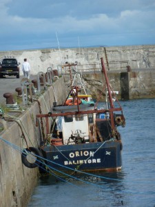
DSCN9646But it’s from the Christian church that the majority of faith-related place-names come. From the time of St Columba at least there were churches and monks here, especially in Port MoCholmaig (St Colman’s Port – Portmahomack), where there was a Pictish monastery. Later there followed Manachainn Rois , the Monastery of Ross. Its previous name had been Feàrn (alder tree) as the monastery moved to Easter Ross from Feàrn, near Edderton, and Fearn is the name the Abbey has kept today in English. Balintore’s old local name was Port an Ab, the Abbot’s port. Templecroft, near Bindal, took its name from Teampall Earach, Easter Temple, a cave in the cliffs where (tradition says) church-services of some kind were held. 

Near Hilton there’s the site of Caibeal Mhoire, St Mary’s Chapel, with the rock called ‘Creag na Baintighearna’, Our Lady’s Rock, on the beach, P1280936and ‘Bàrd Mhoire’, St Mary’s meadow, and Lady Street in the village itself, a name that has certainly existed since pre-Presbyterian centuries. There are wells there too, near the burn (that one was still being used for domestic water needs when I was young), and another near the chapel cemetary site, Lady’s Well, where unbaptised children were buried. The same thing happened beside Clach a’ Charraidh (Monument Stone), the local name for the Shandwick Stone, and it seems likely that those who died of cholera were also buried there. For these poor souls, the amazing Pictish stones with the Christian symbols on them were monuments, indeed.

DSCN9637There’s a part of Portmahomack called Gaza; it’s a Biblical name, and there are two local explanations according to Watson. Either it was because it was like the desert of Gaza with all the sand, or because the minister referred to the residents as ‘muinntir Gaza’ (people of Gaza, i.e. ‘Philistines’) as they were not in the habit of attending church often enough!

Fortresses

The fertile land of Easter Ross was always worth defending, and from the earliest centuries there are many forts, duns and castles, or at least their names, which have come down to us.

ràth – a Celtic or earlier word for a fortified circular enclosure or mound.

> Rhynie = ràthan + i, place of the mounds (there are two, Rhynie and Meikle Rhynie)

P1280881> Rarichie – ràth-riachaidh – ‘fort of the scratching’ (possibly because of the brambles which are still there?). A Pictish fort site, which as late as 1911 was still being called a ‘Danish Fort’ on the OS map. Local people were always very willing to believe that it was the Vikings who were behind every standing stone and mound, even the Pictish stones (I remember myself being told the story ‘that’s where the three king’s sons were buried’ when I was young), and children (like my mother) were always digging for ‘Viking treasure’ below any mound, even on the chapel site.

But we’re hoping to get a lot more information on the Pictish sites here soon with the grand archeological plans that are afoot now:  http://www.scotsman.com/lifestyle/heritage/new-excavations-to-find-lost-pictish-kingdom-1-2925006

dùn – fort

> Dunskaith– Dùn Sgàth, ‘protected fort’, site of a castle built by William the Lion

DSCN5994 Nigg Hill from sea 2006caisteal – castle

> Castlecraig – Caisteal Creag / Creag a’ Chaisteil – connected to Dunskaith;

and the sites of other castle ruins around the area, e.g. Cadboll Castle (Caisteal Chatabol), Ballone (Bail’ an Lòin) – which was called ‘Cast.Tarbat’ on Pont’s map of c.1590.

There’s even the name ‘Battlefield‘,  ‘Blar a’ Chath’, near Tarbat Ness.

In these last 3 issues we’ve been looking at the Gaelic names that dominate the others around the Seaboard under three main headings – settlements and landscape, the coast, faith and fortresses. In the last installment it’ll be the turn of Scots and English names.


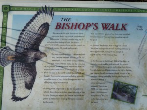
Ma bhios ùine agus ùidh agaibh a-màireach, Disathairne 25 den Cheitean aig 2f, bidh cothrom math ann na naidheachdan arc-eòlach as ùire mu Chlach Neig a chluinntinn fhad’s a tha sibh a’ coiseachd air Slighe an Easbaig, le deasbad is srùbag as a dhèidh.

Barrachd fiosrachaidh an seo:

http://www.niggoldtrust.org.uk/news.asp

fragment-detail


If you have time and interest tomorrow, Sat 25 May at 2pm, there’s a great opportunity to hear the latest archaeological news about the Nigg Stone while strolling round the Bishops’s Walk, followed by discussion and refreshments.

Click link above for more information.


Chaidh sgoilearan clas 6/7 à Bun-sgoil Chnoc na Creige, ann am Baile Dhubhthaich, air turas gu Pàrlamaid Diluain sa chaidh airson seisean tro mheadhan na Gàidhlig.

Class 6/7 GME Craighill Primary, Tain, visited the Scottish Parliament for a Gaelic tour and activities last Monday .

http://parlamaidalba.wordpress.com/2013/05/02/bailedhubhthaich/

Looks like they had fun, especially creating their own MSP profile…


Ainmean-àite ann am Machair Rois 3  –

na Gàidheal: an oirthir

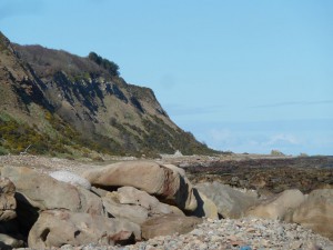
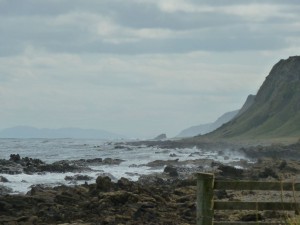
P1280926‘S e oirthir an Ear am pàirt as drùidhtiche den sgìre againn agus tha na h-ainmean-àite a’ toirt fianais air sin. Anns an t-uabhas de dh’ainmean ionadail air creagan sònraichte, mar eisimpleir, chithear cho cudromach agus a bha a’ mhuir aig daoine, airson iasgaich agus mar dhòigh-shiubhail.

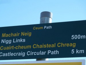
Tha aon Bheinn ann, Beinn Neig. Chan eil e cho àrd ri beanntan eile ann an Ros, ach ‘s e feart gu math greadhnach a th’ ann. Aig a’ cheann eile den ‘Seaboard’, tha Rubha Thairbeirt a’ cumail faire air an leth-eilean.

creag  –   Tha cus ann airson liosta coileanta ach ‘s ann air oirthir an Ear, eadar an Rubha agus Baile a’ Chnuic, a nochdas a’ mhòr-chuid:

Creag Ruadh, Creag Mhaol, Creagan Dubha, Creag a’ Chinn Bhig amssa.

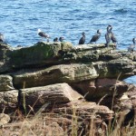
Tha cuid mhòr de na h-ainmean ceangailte ri eòin:

Creag nan Eun, Creag na h-Eala, Rubha na h-Iolaire,

fianais air a’ phailteas de dh’eòin-mhara a bha ann agus a tha ann fhathast an sin.

P1170927 (2)Tha stac, clach, sròn agus ail (creag) ann cuideachd:

Stac Mòr agus Stac Beag , Clach Dhubh, Clach Ghlas, Sròn Liath, Tarail. Tha abairt ann: “Tarail Mhòr is Tarail Bheag is Tarail fo na Chreag”.

Ann an Down to the Sea (J. Macdonald, A. Gordon, J. Sutherland), air fhoillseachadh ann an 1971 bunaichte air rannsachadh nas tràithe, tha mapa làmh-sgrìobhte le ainmean ionadail air cha mhòr gach clach agus creag eadar Baile a’ Chnuic agus Geanies (Gàthan). Bha iad air an cruinneachadh le Anne Gordon agus na peathraichean J. Nic Dhòmhnaill (an sgrìobadair) agus J. Shutharlanach (an dealbhadair), an dithis aca às a’ bhaile, bho na h-iasgairean a b’ aosta. Bha na creagan seo cudromach mar chomharran-mara, airson clèibh a chur sìos agus a lorg, agus airson seòladaireachd.

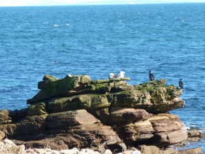
P1280915 ‘S ann sa Ghàidhlig a tha a’ mhòr-chuid agus ‘s e ainmean air leth cuingealaichte a th’ annta; chan eil iad rin lorg air mapaichean ‘oifigeil’.  Tha ainmean dealbhach ann mar ‘Boineid Frangach’ (sic) agus ‘Skaravak’ (creag nan sgarbhan – eòin a-rithist, agus ainm freagareach), Tha feadhainn eile ceangailte ris an eachdraidh ionadail:- ‘Creag na Bainsheann’ (sic) – na Baintighearna, faisg air làrach Caibeal Mhoire, no ri daoine na sgìre: ‘Eilean Sheòrais’, Jessieport, Tom & Mary Port. Bidh mòran de na h-ainmean an sin air an cleachdadh fhathast an-diugh fhèin am measg sheantansan Beurla, oir chan eil ainmean Beurla ann orra.  ‘I’m going to the Porst / Porst Culag / Skaravak / Uilleam’s Pool, the Uaireachan’ amsaa.

P1280902Tha ‘Port Lark’ ann cuideachd, ach tha e coltach nach e eun a tha ann an turas seo; seo cruth Beurla de ‘Làirig’,  ‘Lathaich’ air a mhapa (oidhirp fuaimneachaidh ionadail a sgrìobhadh?)  Tha ‘the Larachans’ ann cuideachd, sreath chreagan ri taobh an Phuirt, ‘s dòcha le ciall ceangailte.

(Ma bhios barrachd fios ionadail aig daoine sam bith mu na h-ainmean seo no feadhainn eile, bhithinn toilichte cluinntinn bhuaibh! Chòrdadh e rium ionnsachadh an uiread ‘s a ghabhas mus tèid a h-uile rud a dhìochuimhneachadh.)

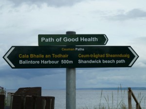
Air taobh eile Rubha Thairbeirt, eadar an taigh-solais agus Port MoCholmaig, ‘s e port an t-ainm as cumanta air a’ chladach. Chan e fìor chalaidhean a tha annta ach acarsaidean beaga, oir tha an taobh sin nas fhasgaiche. ‘S e cruinneachadh inntinneach de dh’ainmean a tha an seo cuideachd, le ainmean pearsanta – Port Uilleim, no tuairisgeulach: Port a’ Chrithinn (craobhan, B. aspen), Port nam Marbh, Port a’ Chaisteil amsaa. ‘S e Port nam Faochag a th’ ann an Wilkhaven, fìor chaladh (ged a tha e beag) faisg air Rubha Thairbeirt.

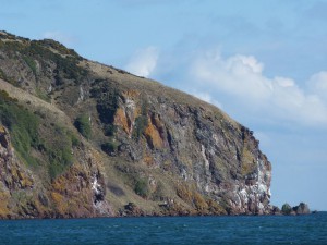
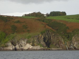
P1280843Aig ceann eile an leth-eilein tha Beinn Neig agus an oirthir mun chuairt oirre, le creagan agus tràighean. Chan eil uiread de dh’ainmean air a’ mhapa an seo, ‘s dòcha gun robh e ro chunnartach dha na h-iasgairean, leis na sgeirean mar ‘the King’s Sons’ agus Creag Dhaibhidh, agus tha mòran uamhan ann mar ‘the King’s Cave’. ‘S dòcha gur e Port an Rìgh a th’ ann am Port an Druidh a-rèir Watson cuideachd, seach ceangal ri draoidhean . Chan eil fìor chinnt ann cò na rìghrean, agus iomadach fionnsgeul mu an cuairt. Ach àrd air mullach na creige tha Castlecraig (creag a’ Chaisteil), comharra cudromach do mharaichean fada a-muigh air a’ mhuir.

Ged a tha argamaidean ann airson freumha Lochlannaich anns an fhacal ‘Neig’ (vik ) mar a chunnaic sinn, is dòcha gun tàinig e bho fhacal Gàidhlig:

eag > gin. eige > an eige (> a’ Neige) : (B. notch, indentation)

Chan eil cinnt ann an e Tràigh Neig fhèin (eag san oirthir), na Sùdraichean, no làrach na seann eaglaise (aig ceann eige san tìr) a bha anns an eag seo. ‘S e ‘place of the tanners’ a bh’ anns Na Sùdraichean, agus mar sin, leis an uiread de leathair a bu chòir a bhith ann, ‘s dòcha gur e an fhìrinn a th’ anns na sgeulachdan mu ghreusaichean!

*************************************************************************************************

Placenames of Easter Ross 3 – the Gaels:

the coast

 From the landscape point of view, the eastern coastline is the most impressive part of our area, and the placenames bear witness to this. In the huge number of local names for particular rocks, for example, we see how important the sea was to people, for fishing and for travel.

There’s one Ben, Beinn Neig – the Hill of Nigg. It’s not as high as other bens in Ross-shire, but it’s still a majestic feature. At the other end of the Seaboard, Rubha Thairbeirt (the Point of Tarbat), Tarbat Ness, watches over the peninsula.

P1280927creag – rock, crag. There are too many too list, but the majorty of named  crags are on the eastern stretch of coast, between Tarbat Ness and Hilton, e.g.

Creag Ruadh (red rock), Creag Mhaol (bald rock), Creagan Dubha (black rocks), Creag a’ Chinn Bhig (rock of the little head) etc.

There are quite a few with names connected to birds:

Creag nan Eun  (rock of the birds), Creag na h-Eala (rock of the swan), Rubha na h-Iolaire (point of the eagle),

evidence of the abundance of seabirds which was and still is to be found there.

There are the names with stac (stack), clach (stone), sròn (nose) and ail (cliff) too, e.g.

Stac Mòr and Stac Beag (big and little stack),  Clach Dhubh (black stone), Clach Glas (blue-grey stone), Sròn Liath (white-grey nose), Tarrel (Tarrail = tar+ail – over-cliff).

There’s saying about the Tarrels: “Tarail Mhòr is Tarail Bheag is Tarail fo na chreag”  (Big Tarrel and Little Tarrel and Tarrel under the Cliffs – Rockfield).

P1200101 (2) 2011 SkaravakIn Down to the Sea (J.Macdonald, A.Gordon, J. Sutherland), printed as a book in 1971 but researched earlier, there’s a hand-written map with the local names of almost every rock and crag between Hilton and Geanies, collected by Anne Gordon and the Hilton sisters Jessie Macdonald and Hansy Sutherland (the illustrator of the book) from the old fishermen.These rocks were important as sea-markers, for setting and locating creels, and for navigation.
The majority of these names are Gaelic, and have a very local reference – you won’t find them on ‘official maps’. There are descriptive names, like ‘Bonaid Frangach’ (Frenchman’s bonnet) and the well-named ‘Skaravak’ (Gaelic sgarbag – pronounced Skaravak, means ‘rock of the cormorants’  – sgarbh=cormorant – birds again). Others are linked to local history:  ‘Creag na Bainsheann’ = Creag na Baintighearna (rock of Our Lady), near the site of the chapel of St Mary, or P1280129 (2)to local characters: ‘Eilean Sheòrais’ – George’s Island, Jessieport, Tom and Mary Port. The Porst itself is just the Gaelic pronunciation of ‘port’. Many of these Gaelic names are still used today in the middle of sentences in English, as there are no English names for them. “I’m going to the Porst / to Porst Culag / to Uilleam’s Pool / the ‘Wireachan’,” etc.

There’s a ‘Port Lark’ too, but this probably has nothing to do with birds this time – it’s an Angliscised version of Port Làirig or Làirich (obscure: ‘port of the site / battlefield/ floor / ruins/ mares’take your pick), given as ‘Laithich’ on the map – possibly an attempt to render the local pronunciation of soft ‘r’ as ‘th’. There are also ‘the Larachans’, a row of rocks beside the Port, which may have a related meaning.

(If anyone has more local knowlege about any of these, please get in touch! I’d love to learn as much as possible about them before it all gets forgotten.)

P1170817 Wilkhaven 2011On the other side of Tarbat Ness, between the lighthouse and Portmahomack, Port is the most common name along the shore. These aren’t real harbours, just small anchorages, as this is the more sheltered side. It’s an interesting collection of names we find there too, including personal names, like ‘Port UIlleim’, or descriptive ones like ‘Port a’ Chrithinn’ (Port of the aspen trees), ‘Port nam Marbh’ (Port of the Dead), ‘Port a’ Chaisteil’ (Castle Port) etc. Wilkhaven is called ‘Port nam Faochag’, which literally means ‘port of the whelks’, a real harbour this time, small though it is, close to Tarbat Ness.

At the other end of the peninsula we have Beinn Neig, the Hill of Nigg, and the the coast around it with its crags and beaches. There fewer names on the map round here, perhaps because it was too dangerous for fishermen, with the ‘King’s Sons’ and ‘Creag Dhaibhaidh’ (Davy’s Rock), and there are many caves, P1280125 (2)like ‘the Kings Cave’. It’s probable that ‘Port an Druidh, noted by Watson, had nothing to do with druids but came from ‘Port an Righ’, King’s Port. It’s not absolutely certain who these kings were, but there are many legends about them. On top of the cliff is Castlecraig (Creag a’ Chaisteil), an important landmark to seamen far out at sea.

Although there are arguments for Viking roots in the word ‘Neig’ (possibly from ‘vik’, as we saw earlier), it’s also quite likely that it came from a Gaelic word:

eag, meaning a notch or cleft, or indentation. ‘The hill of of the cleft’ would be ‘Beinn an eige’ in Gaelic, which could easily have turned into Beinn Neig , and then Nigg. It’s not clear which ‘cleft’ would have been meant – the Bay of Nigg, the Sutors, or the site of Old Nigg Church on the edge of a small ravine. The Sutors in Gaelic are Na Sùdraichean, ‘place of the tanners’, so with all that leather about, perhaps the shoemaker stories are true!


Ainmean-Àite ann am Machair Rois 2
– Na Gàidheil: Bailtean is Cruth na Tìre

P1280117 (2)Chunnaic sinn mìos sa chaidh gu bheil iomadh ainm-àite ann am Machair Rois a thàinig bho na Cruithnich agus na Lochlannaich, ach ‘s ann bhon t-sluagh Ghàidhealach a thàinig a’ mhòr-chuid de na h-ainmean san sgìre seo. Ged a bha cuid Bheurla agus Bheurla Ghallda ri lorg tro na linntean ann an Ros an Ear, mar a chithear ann an artaigil eile, ‘s e prìomh chànan muinntir na sgìre a bha ann an Gàidhlig bho na Meadhan Aoisean tràth a-nuas chun na ficheadamh linne. Air an adhbhar sin bha buaidh Ghàidhlig làidir air na h-ainmean-àite, an dà chuid ann an ainmean gu tur Gàidhlig agus ann an ainmean le ceanglaichean ri cànanan eile, mar a chithear ann an eileamaidean measgaichte agus eadar-theangachaidhean.

Leis gu bheil uiread de dh’ainmean Gàidhlig anns an sgìre, dèiligidh mi ri taghadh comharrail ann an diofar roinnean – an t-seachdain seo bailtean agus cruth na tìre, an ath mhìos cruth na h-oirthir.

Bailtean, tuineachaidhean

Bal-  G. baile  Gnàth-eileamaid as cumanta ann an cruthan Beurla nan ainmean air a’ mhapa, leis cho dùmhail ‘s a bha na tuineachaidhean air an fhearann torrach againn an coimeas ris a’ Ghàidhealteachd air fad.

Balintore (Baile an Todhair) – fianais na h-obrach le lìon o chionn mòran linntean. Bha ‘Balintoir‘ mìle no dhà a-staigh san tìr air mapa Phont (c.1590) agus ‘s e ‘Abotsheaun‘ a tha aige air a’ bhaile air an oirthir. Bha ‘Port an Ab’ cuideachd air Baile an Todhair aig àm WF Watson, c. 1900, air sgàth a’ cheangail ri Manachainn Rois.
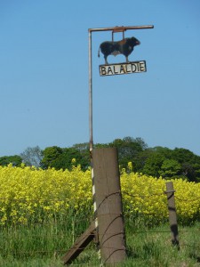
Balaldie  G. Baile + allt + -aigh (seann tuisal ionadach > ie) ; ged nach eil allt ann a-nis. C.f. Loch Slin – an robh drèanadh tuathanasach na b’ fheàrr a’ tioramachadh an fhearainn?
Balnagore  G. Baile na gobhar
Balmuchy  Baile nam muc? Tha ‘Balemucky’ aig Pont (c.1590). Tha an tùs mì-chinnteach, a-rèir Watson. ‘S dòcha bhon Chruithnis ‘Pitmuchy‘ – baile nam muc, air neo bho na seann fhaclan Gàidhlig / Gaeilge ‘much‘ (ceò), no ‘mocha‘ (cailleach-oidhche).

P1210931

Ballone

Ballone / Balloan   Bail’ an lòin                                                                

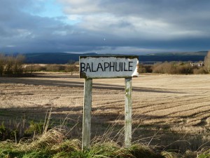
Balaphuile   Baile + poll /phuill

Tha iomadach eiseimpleir eile ann, m.e.
Balnabruach, Balnaha, Balnuig, Balnagall, Balblair, Balinroich, Balachladich, Balindrum, Balcherry.

Tha e coltach gun robh seann tuineachaidhean nam measg air an robh ‘Pit-‘ seach ‘Bal-‘ bho thùs, oir tha eisempleirean gu leòr ann far a bheil ‘Pit’ anns a’ chruth Bheurla agus ‘Baile’ anns an ainm Ghàidhlig, agus far a bheil eileamaid shònrachaidh Gàidhlig as dèidh ‘Pit-‘

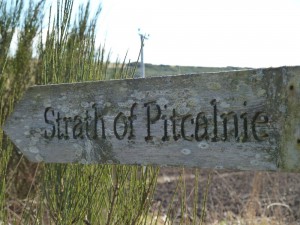
Pitcalnie  Baile-chailnidh,  no Cuilt Eararaidh – tuathanas air an àite chruiaidh, no: cùil far an deach arbhar a dàthadh.  Strath of Pitcalnie Srath Chuilt Eararaidh.
Pitcalzean  Bail’ a Choillean – baile na coille bhige. Pont ‘Pitkaill’ (c.1590)
Pitkerrie  Baile-Chèiridh , bho ciar > cèiread, no bhon fhacal ‘cèir’ – bha sgeulachd ann nach do rinn na seilleanan ach cèir seach mil às a’ chonasg an sin, a-rèir Watson.                                                                                                  

P1280876Pitmaduthy Baile (m)ic Dhuibh

Agus tha ainmean Beurla air a’ mhapa air an robh cruthan Gàidhlig fad linntean:

Broomtown  G. Baile a’ Bhealaidh, Ballewallie ann am Beurla Ghallda. Tha amaladh-cainnte ann a bha beò fhathast c. 1970:
Caorich Baile a’ Bhealaidh ag ithe bealaidh aig beulaibh Baile a’ Bhealaidh.

Cruth na Tìre

A-staigh san tìr chan eil cruthan cho drùidhteach agus a tha iad ann an Ros an Iar, ach tha cnocan, lochan is eile ann a thug ainmean sònraichte dhan sgìre. Ma bheir thu sùil air mapa OS sam bith, chì thu an t-uabhas de dh’ainmean Gàidhlig a tha againn fhathast air feartan na tìre air feadh na sgìre.

Cnoc   Cnocan Seasg (neo-thorrach), Cnoc Taigh Chaluim, Cnoc a’ Mhaide, Cnoc Grìanach,  fiù ‘s Cnoc a’ Mhuillinn Ghaoithe.
Baile a’ Chnuic – ainm Gàidhlig air Hilton; neo ‘Bail’ a’ Chnuinc’, mar a chanadh muinntir na sgìre.

Druim –    Drumancroy (an druima cruaidh), Drumossie (+ mosach), Balindrum.

Allt   Allt nan Dàmh (seann roinn-shealgair air Beinn Neig), air a’ mhapa OS ann an 1911 ‘Aultandown’; Aldie / Balaldie (fiù ‘s gun allt an-diugh).

P1280035 Morich More

A’ Mhoraich Mhòr

Loch    Lochslin (slinn, inneal breabadair, B. sley), nach eil ann tuilleadh,  Loch Eye (faic mìos sa chaidh, Na Lochlannaich), Loch Clais a’ Chrèadha, Loch Dhu, agus iomadach ‘Loch’ beag air a’ Mhoraich Mhòr. Bha ‘Inverlochslin‘ air Inver roimhe > Inbhir na h-aibhne bho Loch Slinne.

Clais     Clashnamuaich (Clais na maigheach), Clais a’ Chreadha

Cul   Culnaha (Cul/Cùl na h-àtha), Cullisse (cùl + lios)

Bog  Bogbain, Am Bog (B. Arabella)

Moraich   (< mor’ oich) = fearann còmhnard ri taobh na mara: a’ Mhoraich Mhòr

Mios sa tighinn bheir sinn sùil air cuid de na h-ainmean Gàidhlig timcheall air an oirthir.

*****************************************************************

Placenames of Easter Ross 2
– the Gaels: townships and the landscape

P1230391 (2)Last month we saw that there are many placenames in Easter Ross which came from  from the Picts and the Vikings, but  the vast majority of placenames in this area came from the Gaels. Although there was some English and Scots used in Easter Ross over the centuries (as we’ll see later), the main language of the local people from the early Middle Ages to the 20th century was Gaelic. For that reason Gaelic had a particularly strong impact on placenames, both in completely Gaelic names and in names with combinations of Gaelic and other languages.

As there’s such a wealth of names, I’ll just be looking at a representative sample here, under different headings, starting this month with townships and the landscape, and the coast next month.

Townships and settlements

Bal – Gaelic baile = township. The one most common basic element in the names on the map in their modern (Anglicised) form, a sign of the density of the population in our fertile area compared with the Highlands as a whole.

Balintore  < Baile an Todhair – bleaching town:  evidence of the local linen industry down the centuries. ‘Balintoir‘ was a mile or two inland on Pont’s map of c.1590, and the harbour settlement was called ‘Abotsheaun‘ (Abbotshaven). In WF Watson’s time (c. 1900) Balintore was also called ‘Port an Ab’ (Abbot’s Port), due to its connections with Fearn Abbey.

Balaldie  <. Baile + allt (stream) + -aigh (typical place-ending) ; although there isn’t a stream there nowadays. Remembering the disappearing Loch Slin, perhaps improved farm drainage led to a general drying out, or rerouting of waterways?
Balnagore  <  Baile na gobhar – town of the goats
Balmuchy   possibly < Baile nam muc – town of the pigs (it’s on Pont’s 1590 map as Balemucky). Origin obscure, according to Watson. Possibly from Pictish for pigs or from Old Gaelic for mist or even owls – take your pick!Ballone / P1210921Ballone / Balloan      < Bail’ an lòin – settlement of the low damp meadow

Balnaphuile  < Baile + poll / phuill – settlement of the boggy pool

There are countless other examples, such as:
Balnabruach, Balnaha, Balnuig, Balnagall, Balblair, Balinroich, Balachladich, Balindrum, Balcherry.

It’s likely that there are very old settlements among those whose names would originally have included the Pictish ‘Pit-‘, instead of the Gaelic ‘Bal-‘. We still see plenty of examples of these mixed elements in placenames wihch have kept the ‘Pit-‘ in their English versions, along with a second Gaelic element:

Pitcalnie  <  Baile-chailnidh,  or Cuilt Eararaidh. “Farm at the hard place”. The second Gaelic name is “secluded spot of the parching”.  Strath of Pitcalnie – Srath Chuilt Eararaidh.
Pitcalzean  <  Bail’ a Choillean – town of the small wood. (Pont ‘Pitkaill’)
Pitkerrie   <  Baile-Chèiridh , < ciar > cèiread (dusk), or from the word ‘cèir‘ (wax) – there was a story that bees could only make wax, not honey, from all the whins there, according to Watson.                                                        

Pitmaduthy  < Pit/Baile (m)ic Dhuibh – Macduff’s stead

And there are English names on the map now for places that had Gaelic names for centuries, for example
Broomtown / Broomton  < Baile a’ Bhealaidh (town of the broom), Ballewallie in Scots.
There’s a Gaelic tongue-twister about it that was still around well into the 20th century:
Caorich Baile a’ Bhealaidh ag ithe bealaidh aig beulaibh Baile a’ Bhealaidh. (“Broomtown sheep eating broom in front of Broomtown”. – It isn’t quite as effective in English!)

The Landscape:

In inland Easter Ross we don’t have the impressive landmarks that Wester Ross has, but we still have our hills, lochs and so on that added their own names to the map. If you look at any OS map, you’ll see the striking number of Gaelic names we still have for landscape features throughout the area.

Cnoc   = hill, e.g. Cnocan Seasg (infertile hills), Cnoc Taigh Chaluim (hill of Calum’s house), Cnoc a’ Mhaide (hill of the stick), Cnoc Grìanach (sunny hill),  even Cnoc a’ Mhuillinn Ghaoithe  (Windmill Hill).
Baile a’ Chnuic – Gaelic names for Hilton; or ‘Bail’ a’ Chnuinc’,  (Bal -a-chruink) as the locals pronounced it.

Druim –    = back, ridge, e.g. Drumancroy (an druima cruaidh= the hard ridge), Drumossie (+ mosach, boggy, moorlike), Balindrum (town of the ridge)

P1230380LochEye

Loch Eye

Allt  = stream, e.g.  Allt nan Dàmh (stream of the deer – old hunting ground on the Hill of Nigg), on the OS map of 1911 as ‘Aultandown’;
Other examples: Aldie,  Balaldie (even if now ‘streamless’)

Loch    Lochslin (loch +slinn, weaving implement, English ‘sley’), no longer extant, Loch Eye (see last month – the Vikings), Loch Clais a’ Chrèadha (loch of the clay hollow), Loch Dhu (black), and many other tiny lochs on the Moraich Mòr. Inver used to be called ‘Inverlochslin‘ > at the mouth of the river from Loch Slin.

P1280946Clais   = ditch, hollow, e.g. Clashnamuaich (Clais na maigheach – hollow of the hares), Clais a’ Chreadha (clay hollow)

Cul  = back, nook,  e.g. Culnaha (Cul/Cùl na h-àtha – ‘kiln-nook’), Cullisse (cùl + lios – garden, enclosure)

Bog = marsh, moss, soft ground , e.g. Bogbain (white marsh), Am Bog (The Marsh – renamed Arabella)

Moraich = sea plain, as in the Morrich More / a’ Mhoraich Mhòr – ‘the big plain by the sea’

Next time we’ll look at some of the many Gaelic placenames around the Seaboard coastline.

Anyone who’s seriously interested in local names should try to get hold of ‘Place Names of Ross and Cromarty’ by WJ Watson, originally published in 1904, reprinted 1976. There are also wonderful old maps you can look at on the website of the national Library of Scotland: http://maps.nls.uk/scotland/index.html